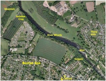
- The Boston Spa Riverside Trail – Deep Dale to Holgate
This feature will grow as material is being added so feel free to re-visit and hopefully observe progress! (last updated February 2013)
In 2008 Boston Spa Parish Council commissioned us to survey the area between Deep Dale and Holgate in order to help inform their management of the woodland along that stretch of the river.
The survey focussed in detail on the archaeobotany of the hedgerows, woodland and ground flora. The report we produced also covered the sites with archaeological, geological and historical interest.
Some important sites included in the Heritage List:
- Leys Lane prehistoric flint site
- Wray Wood and ‘sheepwash’
- Early stock-control enclosure
- Prehistoric pit alignments
- Ancient track-way into Deep Dale
- Deep Dale information board.
- Jackdaw Crag carvings
- Limestone cliffs
- Ancient site by Jackdaw Crag
- West End Estate
- Managed woodland along riverside cliffs
- Church Fields and old field systems
- Disused quarries amongst the cliffs
- Cave
- Holgate
- Dam House and Weir
